


Bine ați venit la Hurghada Excursie / DE CE ESTE MAREA ROȘIE NUMIT MAREA ROȘIE?
În acest articol, vom vorbi despre toate informațiile referitoare la Marea Roșie, în ceea ce privește suprafața, lungimea, lățimea, adâncimea maximă a Mării Roșii, cele mai importante organisme care trăiesc în ea, și cel mai bun marine programe și activități în scopul pentru vizitatori de a determina destinația lor, fie la Hurghada sau Sharm El Sheikh, precum și Marsa Alam și Porto Ghalib-Hurghada Excursii de o Zi
-Alegeți din peste 50 de oferte de excursii cu barca și excursii istorice în Hurghada
– over 20 boat trips and historical excursions in Marsa Alam
– 30 de excursii cu barca și excursii istorice potrivit bugetului în sharm el sheikh
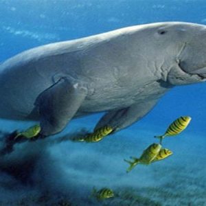
Mare biodiversitate de la Marea Roșie a determinat experții să-l numesc o minune naturală. Relativ constantă temperatura apei de 20°C la 30°C (68°F – 86°F), precipitații ușoare din cauza mai puțin ploaie moderată și curenți, și conținut ridicat de sare care rezultă dintr-o mare rata de evaporare și nivel scăzut de umiditate a crea un mediu ideal pentru cresterea coralilor. Marea Roșie este cel mai fiziologic de susținere a vieții mare din lume și una dintre cele mai bogate mări în termeni de concentrare a vieții marine în toate mările tropicale.
De ce este Marea Roșie numit Marea Roșie? Este adevărat roșu?
Nu, Marea Roșie nu este întotdeauna roșu, dar, uneori, se pare a fi de culoare roșie. Marea Roșie primit numele de la un fenomen cauzat de un tip de alge numită Trichodesmium Erythraeum, care se găsește în mare. Când algele moare, de culoare verde-albastru al mării pare a modifica la o culoare roșu-brun.
Dezvoltarea turismului și impactul lor asupra bogat și vulnerabile mediului marin a condus guvernul Egiptean să declare în 1983 Ras Mohammed Peninsula primul Egiptean parc național.
RED SEA- Hurghada Day Trips
There are more than 1,000 species of invertebrates, about 200 recorded species of corals and more than 1,000 species of fish that can be found in this natural wonder. Twenty million years ago the Red Sea was formed when the Arabian Peninsula was torn from Africa. One hundred and fifty years ago, it was one of the major shipping routes connecting Europe with East Asia and Australia. Today, the magical allure of the Red Sea is hidden just below the surface, where the excellent clarity and mild water temperatures make diving possible all year round.
The Red Sea is the entrance to the Indian Ocean between Africa and Asia. Connecting to the ocean in the south through the sound of Bab al-Mandab and the Gulf of Aden. In the north are the Sinai Peninsula, the Gulf of Aqaba or the Gulf of Eilat and the Gulf of Suez (leading to the Suez Canal).
Occupying part of the Great Rift Valley, the Red Sea has an area of about 174,000 square miles (450,000 km2): it is about 1,200 miles (1,900 km) long and, at its widest point, more than 190 miles (300 km) wide. . It has a maximum depth of 8,200 feet (2,500 metres) in the Central Trench and an average depth of 1,640 feet (500 metres), but there are also extensive shallow shelves, famous for marine life and corals. The sea is home to more than 1,000 species of invertebrates and 200 species of hard and soft corals and is the most northerly tropical sea in the world.
RED SEA- Hurghada Day Trips
The Red Sea is one of the most saline water bodies in the world, which is governed by the effects of the water circulation pattern resulting from evaporation and wind stress in the Red Sea. Salinity ranges from 36 to 38.
Noun
The Red Sea is a direct translation of Latin Mare Erythraeum and Arabic Al-Bar Al-Amar (The Red Sea) and Tigrinya Qeyḥ Baḥrī
The name of the sea does not indicate the color of the water because it is not red. It may refer to the seasonal flowering of the red-colored cyanobacterium Trichodesmium erythraeum near the surface of the water. Some suggest that it refers to the mineral-rich red mountains nearby which are called Harei Edom Edom, meaning “pink skin,” is also an alternate Hebrew name for the red-faced Biblical character Esau (Jacob’s brother), and the nation descended from him, the Edomites, which in turn provides another possible origin for the Red Sea.
There is also speculation that the name Red Sea came from a mistranslation of what should have been the Red Sea in the biblical account of Exodus.
Another hypothesis is that the name comes from the Himyarites, a local group whose name means red.
Another theory favored by some modern scholars is that the red name indicates the direction of the south, in the same way that the name of the Black Sea might refer to the north. The basis of this theory is that some Asian languages use colored words to indicate cardinal directions.
A final theory indicates that it was so named because it is located on the borders of the Egyptian desert, which the ancient Egyptians called the dashret or “red land”. So it could have been the Red Earth Sea.
Date
The Egyptians were the first to attempt an exploration mission in the Red Sea. In the Bible, the Exodus story tells of how Moses, the son of a slave woman, led the people of Israel through its headwaters, (most likely the Sea of Reeds which has since disappeared due to the diversion of the waters of the Suez Canal) to freedom, using God’s powers to divide the waters. However, it was a Greek sailor, Hippalos, who gave an international dimension to the Red Sea in his manifesto for the voyage of the Eritrean Sea, thus opening it to enormous and exclusive trade with Asia.
RED SEA
It was only from the fifteenth century onwards that Europe began to show interest in this field. In 1798, France commissioned General Bonaparte to invade Egypt and capture the Red Sea. Although he failed in his mission, the engineer J.B. Leberry, who took part in it, revived the plan of the canal envisaged during the reign of the pharaohs. The Suez Canal was opened in November 1869. At that time, the British, French and Italians shared trading posts. Jobs were gradually dismantled after World War I. After World War II, the Americans and Soviets exercised their influence while the volume of oil tanker traffic intensified. However, the Six-Day War culminated with the closure of the Suez Canal from 1967 to 1975. The Suez Canal remains today, despite the patrols of the major navies in the waters of the Red Sea, never regaining its dominance at the Cape. which are believed to be less vulnerable.
oceanography
The Red Sea is located between arid land, desert and semi-desert. The main reasons for better development of coral reef systems along the Red Sea are because of its great depths and efficient water circulation pattern, the Red Sea water mass exchanges its waters with the Arabian Sea and the Indian Ocean via the Gulf of Aden. These physical factors reduce the effect of high salinity from evaporation, cold water in the north and relatively hot water in the south.
Climate: The climate of the Red Sea is caused by two distinct seasonal seasons. Northeast monsoon and southwest monsoon. Monsoons occur due to the difference in heating between the land surface and the sea. Very high surface temperatures combined with high salinity make it one of the hottest and saltiest bodies of sea water in the world. The average surface water temperature of the Red Sea during the summer is about
RED SEA- Hurghada Day Trips
Geology

The Red Sea formed by Arabia splitting from Africa due to continental drift. This split started in the Eocene and accelerated during the Oligocene. The sea is still widening and it is considered that the sea will become an ocean in time (as proposed in the model of Tuzo Wilson).
Sometimes during the Tertiary period the Bab el Mandeb closed and the Red Sea evaporated to an empty hot dry salt-floored sink. Effects causing this would be:-
- A “race” between the Red Sea widening and Perim Palestine erupting filling the Bab el Mandeb with lava.
- The lowering of world sea level during the Ice Ages due to much water being locked up in the ice caps.
Today surface water temperatures remain relatively constant at 70–77 °F (21–25 °C) and temperature and visibility remain good to around 660 feet (200 m), but the sea is known for its strong winds and tricky local currents.
In terms of salinity, the Red Sea is greater than the world average, approximately 4 percent. This is due to several factors: 1) high rate of evaporation and very little precipitation, 2) a lack of significant rivers or streams draining into the sea, and 3) limited connection with the Indian Ocean (and its lower water salinity).
Desalination Plants
The Red Sea water is an essential asset. There is extensive demand of desalinated water to meet the requirement of the population and the industries along the Red Sea.
There are at least 18 desalination plants along the Red Sea coast of Saudi Arabia which discharge warm brine and treatment chemicals(chlorine and anti-scalants) that may cause bleaching and mortality of corals and diseases to the fish stocks. Although this is only a localized phenomenon, it may intensify with time and have a profound impact on the fishing industry.
The water from the Red Sea is also utilized by oil refineries and cement factories for cooling purposes. Used water drained back into the coastal zones may cause harm to the nearshore environment of the Red Sea.
RED SEA- Hurghada Day Trips
Facts and Figures at a Glance
-
- Length: ~1900 km – 79 % of the eastern Red Sea with numerous coastal inlets
-
- Maximum Width: ~ 306 – 354 km – Massawa (Eritrea)
- Minimum Width: ~ 26 – 29 km -Strait Bab al Mandeb (Yemen)
- Average Width: ~ 280 km
- Average Depth: ~ 490 m
- Maximum Depth: ~2850 m
- Total surface Area: 438 x 103- 450 x 103 km²
- Volume: 215 x 103 –251 x 103 km³
-
- Approximately 40 % of the Red Sea is quite shallow (under 100 m) whereas about 25 % of the Red Sea is under 50 m deep. About 15 % of the Red Sea is over 1000 m depth that forms the deep axial trough.
- Shelf breaks are marked by coral reefs
- Continental slope has an irregular profile (series of steps down to ~500 m)
- Centre of Red Sea has a narrow trough (~ 1000 m; some deeps may exceed 2500 m)
RED SEA- Hurghada Day Trips
Some of the Research cruises in the Red Sea
Numerous research cruises have been conducted
-
- Arabia Felix (1761-1767)
- Vitiaz (1886-1889)
- Valdivia (1898-1894)
- Pola (1897-98) Southern Red Sea and (1895/96 – Northern Red Sea
- Ammiraglio Magnaghi (1923/24)
- Snellius (1929 –1930)
- Mabahiss (1933-1934 and 1934-1935)
- Albatross (1948)
- Manihine (1849 and 1952)
- Calypso (1955)
- Atlantis and Vema (1958)
- Xarifa (1961)
- Meteor (1961)
- Glomar Challenger (1971)
- Sonne 1997
- Meteor 1999
RED SEA- Hurghada Day Trips
Tourism
The sea is known for its spectacular dive sites such as Ras Mohammed, SS Thistlegorm (ship wreck), Elphinstone, The Brothers and Rocky Island in Egypt, Dolphin Reef in Eilat Israel and less known sites in Sudan such as Sanganeb, Abington, Angarosh and Shaab Rumi (see photo above).
The Red Sea was “discovered” as a diving destination by Hans Hass in the 1950s, and by Jacques-Yves Cousteau later. Popular tourist resorts include Sharm-El-Sheikh and Hurghada (and recently Marsa Alam) in Egypt, as well as Eilat, Palestine in an area known as the Red Sea Riviera.
Bordering countries
Bordering countries are:
- Northern shore:
- Egipt
- Palestine
- Jordan
- Western shore:
- Sudan
- Egipt
- Eastern shore:
- Arabia Saudită
- Yemen
- Southern shore:
- Somalia
- Djibouti
- Eritrea
Towns and cities
Towns and cities on the Red Sea coast include:
- Aqaba العقبة ,
- Dahabدهب ,
- Eilat אילת ,
- Hala’ib حلايب ,
- Al Hudaydah الحديدة,
- Hurghada الغردقة,
- Jeddahجدة ,
- Marsa Alamمرسى علم ,
- Nuweiba نويبع ,
- Port Safaga ميناء سفاجا ,
- Port Sudan بورت سودان ,
- Sharm el Sheikh شرم الشيخ ,
- Suakin سواكن,
- El Suweis السويس ,
- Taba الطور,
- El-Tor الطور
the best marine programs and activities in order for visitors to determine their destination, whether to Hurghada sau Sharm El Sheikh, as well as Marsa Alam and Porto Ghalib
Comentariu (0)